
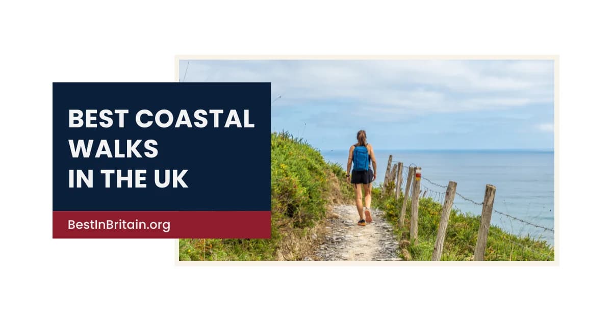
The United Kingdom has thousands of miles of coastline, ranging from high sea cliffs and sandy bays to estuaries, tidal islands, fishing villages and exposed Atlantic headlands. Some of the country’s most memorable landscapes are best understood on foot, where changes in tide, geology, weather and wildlife become far more visible than they do from the road.
The best coastal walk is not always the longest or most difficult. A short route around a headland can be as rewarding as a full-day section of a national trail, particularly when it combines strong views with history, beaches, wildlife or a clear sense of place. Conditions can also vary significantly depending on tides, wind and erosion.
This guide brings together 25 of the best coastal walks in the UK. It is not a rigid ranking. Instead, it highlights routes that stand out for their scenery, character and overall walking experience across England, Scotland, Wales and Northern Ireland.
Best coastal walks in England
1. Walk from Seven Sisters to Eastbourne
Route: Seaford to Eastbourne, East Sussex
Walk details:
- Approximate distance: 13 miles
- Difficulty: Challenging, with repeated steep climbs and descents
- Recommended duration: 5 to 7 hours
Price: Free
This is one of England’s defining clifftop walks.
The route follows the chalk cliffs of the Seven Sisters before continuing past Birling Gap and Beachy Head towards Eastbourne. Wide views across the Channel, rolling downland and the repeated rise and fall of the cliffs create a demanding but exceptionally rewarding day.
There is very little shelter on exposed sections, and cliff edges are unstable.
Pro tip:
Walk from Seaford towards Eastbourne for the strongest sequence of views and use public transport to avoid returning the same way.
2. Follow the South West Coast Path from St Ives to Zennor
Route: St Ives to Zennor, Cornwall
Walk details:
- Approximate distance: 6.5 miles
- Difficulty: Challenging, with rough and uneven coastal terrain
- Recommended duration: 4 to 6 hours
Price: Free
The path between St Ives and Zennor is one of the wildest and most beautiful sections of the Cornish coast.
Granite cliffs, hidden coves and open Atlantic views create a route that feels remote despite beginning in one of Cornwall’s busiest towns. The terrain is rocky and more demanding than the modest mileage suggests.
Zennor provides a natural finish with a church, village atmosphere and transport options back towards St Ives.
Pro tip:
Allow more time than expected and avoid attempting the route in poor visibility or after prolonged heavy rain.
3. Walk from Lulworth Cove to Durdle Door
Route: West Lulworth, Dorset
Walk details:
- Approximate distance: 3 miles return
- Difficulty: Moderate, with steep climbs
- Recommended duration: 2 to 3 hours
Price: Free, with parking charges
This short Jurassic Coast walk links two of Dorset’s most recognisable landmarks.
The route climbs steeply from Lulworth Cove before crossing open cliffs towards Durdle Door and Man O’War Bay. The views are immediate and dramatic, making this one of the strongest short coastal walks in southern England.
The path can be crowded and slippery, particularly after rain.
Pro tip:
Start early and continue beyond the main Durdle Door viewpoint for a quieter perspective on the coastline.
4. Explore the cliffs from Whitby to Robin Hood’s Bay
Route: Whitby to Robin Hood’s Bay, North Yorkshire
Walk details:
- Approximate distance: 7 miles
- Difficulty: Moderate
- Recommended duration: 3 to 5 hours
Price: Free
This section of the Yorkshire coast combines clifftop walking with two of England’s most atmospheric coastal settlements.
The route leaves Whitby near the abbey and follows high cliffs, farmland and exposed coastline before descending into Robin Hood’s Bay. The contrast between open coast and the tightly packed fishing village creates a memorable finish.
Some cliff sections are vulnerable to erosion and route diversions can occur.
Pro tip:
Walk south from Whitby and use the bus back, allowing time to explore Robin Hood’s Bay before leaving.
5. Walk around Land’s End to Sennen Cove
Route: Land’s End to Sennen Cove, Cornwall
Walk details:
- Approximate distance: 4 miles one way
- Difficulty: Moderate
- Recommended duration: 2 to 4 hours
Price: Free, with parking charges
The route between Land’s End and Sennen provides a more rewarding experience than visiting the famous landmark by car alone.
Granite cliffs, offshore rocks and broad Atlantic views lead towards one of west Cornwall’s best beaches. The path reveals a wilder coastline beyond the commercial visitor complex.
Wind and exposure can make the route feel much more demanding than the distance suggests.
Pro tip:
Walk towards Sennen and return by bus or taxi if you do not want to retrace the route.
6. Follow the coast from Bamburgh to Seahouses
Route: Bamburgh to Seahouses, Northumberland
Walk details:
- Approximate distance: 3.5 miles
- Difficulty: Easy to moderate
- Recommended duration: 2 to 3 hours
Price: Free
This walk combines one of Britain’s strongest castle views with a broad sandy coast.
Bamburgh Castle dominates the opening section before the route continues south along beaches and dunes towards Seahouses. Views towards the Farne Islands add another layer, particularly in clear weather.
The walk is relatively straightforward, though tides and soft sand can affect progress.
Pro tip:
Check the tide and walk on the beach where safe for the best view back towards Bamburgh Castle.
7. Walk the Old Harry Rocks circuit
Route: Studland, Dorset
Walk details:
- Approximate distance: 3.5 miles
- Difficulty: Easy to moderate
- Recommended duration: 2 to 3 hours
Price: Free
Old Harry Rocks provide one of the finest short clifftop walks on the Dorset coast.
The route leads from Studland towards chalk stacks and broad views across Poole Bay and the Isle of Wight. Longer circular options continue through farmland and downland before returning to the village.
The cliffs are high and unstable, with no barriers in many places.
Pro tip:
Keep well back from the edge and visit outside the busiest midday period for a quieter route.
8. Explore the Norfolk coast from Holkham to Wells
Route: Holkham to Wells-next-the-Sea, Norfolk
Walk details:
- Approximate distance: 6 miles
- Difficulty: Easy
- Recommended duration: 3 to 4 hours
Price: Free, with parking charges
This route crosses one of England’s most spacious coastal landscapes.
Broad sands, pinewoods, dunes and salt marsh create a walk defined by scale rather than cliffs or dramatic elevation. The finish at Wells brings colourful beach huts and access to the harbour town.
Tides and channels can change the safest line across the beach.
Pro tip:
Use the firmer paths near the pinewoods when the sand is soft or the tide is high.
9. Walk around Flamborough Head
Route: Flamborough, East Yorkshire
Walk details:
- Approximate distance: 7 miles for a full circuit
- Difficulty: Moderate
- Recommended duration: 3 to 5 hours
Price: Free
Flamborough Head offers chalk cliffs, sea caves, lighthouses and major seabird colonies.
The headland paths provide repeated views over the North Sea and are particularly rewarding during nesting season. Shorter routes can be created around North Landing, South Landing or the lighthouse.
Cliff edges and changing weather require caution throughout the year.
Pro tip:
Bring binoculars in seabird season and avoid disturbing nesting areas or leaving marked paths.
10. Walk the coast from Cromer to Overstrand
Route: Cromer to Overstrand, Norfolk
Walk details:
- Approximate distance: 3 miles
- Difficulty: Easy to moderate
- Recommended duration: 1.5 to 2.5 hours
Price: Free
This short route combines traditional seaside character with open cliff and beach views.
Leaving Cromer’s pier and town centre, the walk continues east towards Overstrand along the coast path or beach depending on conditions. It provides a quieter perspective on the north Norfolk coast without requiring a full-day hike.
Cliff erosion and tide conditions can affect access.
Pro tip:
Check the tide and use the clifftop path if the beach route is restricted or unsafe.
Best coastal walks in Scotland
11. Walk the Quiraing circuit
Route: Trotternish, Isle of Skye
Walk details:
- Approximate distance: 4 miles
- Difficulty: Moderate to challenging
- Recommended duration: 3 to 4 hours
Price: Free, with parking charges
The Quiraing is technically a mountain and coastal landscape rather than a beach walk, but its sea views and extraordinary landforms make it one of Scotland’s most memorable routes.
Cliffs, pinnacles and landslips rise above the coast of Skye, with views towards the mainland and surrounding islands. The terrain is uneven and can become difficult in poor weather.
Its popularity means the main parking area fills quickly.
Pro tip:
Start early and complete the full circuit only in suitable weather and footwear.
12. Walk from Elgol to Camasunary
Route: Elgol, Isle of Skye
Walk details:
- Approximate distance: 9 miles return
- Difficulty: Moderate
- Recommended duration: 4 to 6 hours
Price: Free
This route provides exceptional views towards the Cuillin from the south of Skye.
The path follows a rugged coastline from Elgol to Camasunary Bay, combining cliffs, sea views and dramatic mountain scenery. The destination feels remote even though the route begins near a small village.
The path can be rough and exposed in wet or windy conditions.
Pro tip:
Carry enough food and water and allow extra time for photographs and changing weather.
13. Explore the coast at Sandwood Bay
Route: Near Kinlochbervie, Sutherland
Walk details:
- Approximate distance: 8 miles return
- Difficulty: Moderate
- Recommended duration: 4 to 6 hours
Price: Free
The walk to Sandwood Bay leads across open moorland to one of mainland Britain’s wildest beaches.
The route is not continuously coastal, but the arrival at the broad bay, dunes and sea stack of Am Buachaille is unforgettable. There are no visitor facilities at the beach and little shelter.
Its remoteness demands self-sufficiency and careful timing.
Pro tip:
Carry full waterproofs, food, water and navigation, and leave enough daylight for the return journey.
14. Walk the Mull of Galloway
Route: Mull of Galloway, Dumfries and Galloway
Walk details:
- Approximate distance: 3 to 5 miles depending on route
- Difficulty: Easy to moderate
- Recommended duration: 2 to 4 hours
Price: Free
The Mull of Galloway is Scotland’s most southerly point and offers broad sea views from high cliffs.
Short routes link the lighthouse, nature reserve and dramatic headland. On clear days, views can extend towards the Isle of Man and the coasts of Ireland and Cumbria.
The area is particularly strong for birdlife and changing coastal light.
Pro tip:
Visit in clear weather if possible and follow reserve guidance during seabird nesting season.
15. Walk the Fife Coastal Path from Elie to Anstruther
Route: Elie to Anstruther, Fife
Walk details:
- Approximate distance: 10 miles
- Difficulty: Moderate
- Recommended duration: 4 to 6 hours
Price: Free
This section of the Fife Coastal Path links beaches, harbours, villages and historic coastal landmarks.
The route passes St Monans and Pittenweem before finishing in Anstruther, creating one of Scotland’s strongest village-to-village coastal walks. The varied scenery keeps the route interesting throughout.
Public transport makes it easy to complete as a one-way walk.
Pro tip:
Walk west to east and allow time for harbour stops rather than treating the route as a race to Anstruther.
16. Explore the St Abb’s Head circuit
Route: St Abbs, Scottish Borders
Walk details:
- Approximate distance: 4 miles
- Difficulty: Moderate
- Recommended duration: 2 to 3 hours
Price: Free, with parking charges
St Abb’s Head offers dramatic cliffs, seabird colonies and one of south-east Scotland’s strongest short coastal walks.
The route climbs from the village or reserve car park towards the lighthouse and high viewpoints above the North Sea. Sea stacks, coves and birdlife give the landscape real depth.
The cliffs are exposed and can be dangerous in strong wind.
Pro tip:
Check the forecast and keep well back from the edge, particularly during nesting season.
Best coastal walks in Wales
17. Walk from Rhossili to Worm’s Head
Route: Rhossili, Gower Peninsula
Walk details:
- Approximate distance: 4 to 6 miles depending on the route
- Difficulty: Moderate
- Recommended duration: 2 to 4 hours
Price: Free, with parking charges
Rhossili offers one of the finest combinations of beach, cliffs and headland scenery in Wales.
The clifftop route leads towards Worm’s Head with broad views across Rhossili Bay. At low tide, experienced and properly prepared walkers may continue across the causeway to the outer headland.
The tidal crossing can become dangerous very quickly.
Pro tip:
Check official safe crossing times and never attempt to reach Worm’s Head when the tide window is uncertain.
18. Walk from Tenby to Saundersfoot
Route: Tenby to Saundersfoot, Pembrokeshire
Walk details:
- Approximate distance: 4.5 miles
- Difficulty: Moderate
- Recommended duration: 2 to 4 hours
Price: Free
This section of the Pembrokeshire Coast Path links two of south Wales’s best-known seaside towns.
Wooded cliffs, beaches and changing views across Carmarthen Bay create a route with more variety than its modest length suggests. The ability to return by bus makes it practical for a short coastal day.
Steep steps and uneven sections add physical challenge.
Pro tip:
Walk from Tenby towards Saundersfoot and return by public transport after exploring the harbour.
19. Explore the Marloes Peninsula
Route: Marloes, Pembrokeshire
Walk details:
- Approximate distance: 5 to 7 miles
- Difficulty: Moderate
- Recommended duration: 3 to 5 hours
Price: Free, with parking charges
The Marloes Peninsula combines cliffs, beaches, islands and some of the finest coastal scenery in Pembrokeshire.
Routes can include Marloes Sands, Deer Park and views towards Skomer Island. Wildlife, geology and broad Atlantic exposure give the area a wild quality despite its accessibility.
There is little shelter on exposed sections.
Pro tip:
Bring binoculars and choose the exact circuit according to weather, tide and wildlife interests.
20. Walk from Llangrannog to Cwmtydu
Route: Ceredigion, Wales
Walk details:
- Approximate distance: 6 miles
- Difficulty: Challenging in places
- Recommended duration: 3 to 5 hours
Price: Free
This section of the Wales Coast Path follows a dramatic part of Cardigan Bay.
Steep climbs, hidden coves and open sea views create a route that feels much wilder than the nearby villages suggest. Dolphins may sometimes be seen offshore, although sightings are never guaranteed.
The repeated ascents make the walk physically demanding.
Pro tip:
Use public transport or arrange a pickup, and carry enough water for the exposed climbs.
21. Walk around Llanddwyn Island
Route: Newborough, Anglesey
Walk details:
- Approximate distance: 5 to 7 miles depending on the starting point
- Difficulty: Easy to moderate
- Recommended duration: 3 to 4 hours
Price: Free, with parking charges
The walk to Ynys Llanddwyn crosses forest, dunes and beach before reaching a tidal island associated with the Welsh patron saint of lovers.
Lighthouses, church ruins and views towards the mountains of Eryri create one of Wales’s most distinctive coastal routes. The island feels remote despite being relatively accessible.
Tides can affect safe access around the outer sections.
Pro tip:
Check the tide and allow time to explore the island rather than turning back at the first lighthouse view.
Best coastal walks in Northern Ireland
22. Walk the Causeway Coast from Portballintrae to the Giant’s Causeway
Route: Portballintrae to the Giant’s Causeway, County Antrim
Walk details:
- Approximate distance: 5 miles
- Difficulty: Moderate
- Recommended duration: 2 to 4 hours
Price: Free on foot
This route provides a quieter way to approach Northern Ireland’s most famous natural landmark.
The path follows beaches, dunes and cliffs before arriving above the basalt columns of the Giant’s Causeway. The changing approach gives more context than arriving directly by car or coach.
Weather and cliff conditions can affect exposed sections.
Pro tip:
Walk towards the Giant’s Causeway and use local transport for the return if you do not want to retrace the route.
23. Explore the cliffs at Fair Head
Route: Near Ballycastle, County Antrim
Walk details:
- Approximate distance: 3 to 5 miles depending on route
- Difficulty: Moderate
- Recommended duration: 2 to 4 hours
Price: Free, with possible parking charges
Fair Head rises dramatically above the north Antrim coast and provides one of Northern Ireland’s strongest clifftop walks.
The route crosses open farmland and rough ground before reaching views over Rathlin Island and the wider coast. The cliffs are important for climbing as well as walking.
Access may cross working farmland and requires respectful behaviour.
Pro tip:
Follow signed access routes, close gates and keep well away from exposed cliff edges.
24. Walk through Murlough Nature Reserve to Newcastle
Route: Murlough to Newcastle, County Down
Walk details:
- Approximate distance: 5 miles
- Difficulty: Easy to moderate
- Recommended duration: 2 to 4 hours
Price: Free, with parking charges
This route combines dunes, beach and views towards the Mourne Mountains.
Murlough’s boardwalks and protected habitats lead towards a long sandy shoreline, while Newcastle provides a clear destination beneath Slieve Donard. The contrast between open beach and mountain backdrop makes the walk particularly memorable.
The reserve is environmentally sensitive and marked routes should be respected.
Pro tip:
Use the boardwalks through the dunes and return by local transport if conditions make a beach return less appealing.
25. Walk the Gobbins coastal path
Route: Islandmagee, County Antrim
Walk details:
- Approximate distance: guided route of around 3 miles
- Difficulty: Challenging, with bridges, steps and exposed sections
- Recommended duration: around 3 hours
Price: £££
The Gobbins is one of the UK’s most unusual coastal walking experiences.
A guided route follows bridges, tunnels and cliffside paths close to sea level. The experience is highly managed and differs from an ordinary open-access coast path, but the proximity to the water and engineering of the route make it memorable.
Access depends on weather, fitness requirements and advance booking.
Pro tip:
Book early, wear the required footwear and read all access restrictions before travelling.
How to plan a coastal walk in the UK
Coastal walks require more preparation than their mileage alone suggests. Repeated climbs, exposed cliffs, soft sand, rough paths and strong wind can turn a short route into a demanding day.
Check the tide before setting out. Routes around Worm’s Head, Llanddwyn, beaches, estuaries and tidal islands can become dangerous or impossible at high water. Never assume that a route used earlier in the day will remain open on the return.
Cliff erosion is another major risk. Keep well back from cliff edges, obey closures and avoid standing beneath unstable rock faces. Recent rain, frost and storms can weaken ground without obvious warning.
Public transport often improves the experience by allowing one-way walks. Routes between Whitby and Robin Hood’s Bay, Elie and Anstruther, Tenby and Saundersfoot and several sections of the Wales Coast Path are particularly suitable for bus or rail connections.
Carry waterproof clothing, water, food and a charged phone even on short routes. Mobile coverage can be unreliable on remote sections, so download maps and transport details before departure. Proper walking footwear is essential on rocky, muddy or steep paths.
Wildlife should be viewed without disturbance. Keep dogs under control around livestock, nesting birds and cliff colonies, and follow local restrictions in nature reserves. Take all litter away and avoid leaving marked paths through dunes or sensitive habitats.
The strongest coastal walks are not necessarily the longest. Seven Sisters, St Ives to Zennor and Llangrannog to Cwmtydu provide demanding full-day experiences, while Durdle Door, Old Harry Rocks, St Abb’s Head and Llanddwyn offer memorable scenery within a shorter route. The best choice depends on fitness, weather, tide and how much time you want to spend exploring the places at either end.
Related guides

Business Services
20 best forests and woodlands in the UK for a memorable escape
Discover the best forests and woodlands across the United Kingdom, from ancient royal hunting grounds and Highland pinewoods to mountain-biking forests, wildlife reserves and peaceful woodland walks.
Updated 17 July 2026
Business Services
20 best islands in the UK to visit for a memorable escape
Discover the best islands across the United Kingdom, from the Hebrides and northern archipelagos to Welsh coastal islands, English island escapes and dramatic island landscapes in Northern Ireland.
Updated 16 July 2026

Business Services
25 best stately homes in the UK for a memorable visit
Discover the best stately homes across the United Kingdom, from grand ducal palaces and aristocratic estates to remarkable country houses with outstanding interiors, gardens and wider landscapes.
Updated 15 July 2026

Business Services
25 best gardens in the UK for a memorable visit
Discover the best gardens across the United Kingdom, from great botanical collections and formal historic gardens to experimental planting, woodland gardens and outstanding landscape design.
Updated 30 June 2026

Business Services
15 best road trips in the UK for an unforgettable journey
Discover the best road trips across the United Kingdom, from Scotland’s North Coast 500 and Wales’s mountain routes to coastal drives through Cornwall, Northern Ireland and some of England’s most scenic landscapes.
Updated 28 June 2026
Business Services
30 best walks and hiking routes in the UK for unforgettable landscapes
Discover the best walks and hiking routes across the United Kingdom, from famous mountain climbs and dramatic ridges to national trails, moorland paths, lakeside routes and accessible scenic walks.
Updated 27 June 2026
Know a business we should consider?
Send us the details and our editorial team will review whether it fits a future guide.
Submit businessWriter profile
George Davies
Regional and city guide desk researcher
George researches location-led guides, city roundups, regional comparisons, attractions, and practical local recommendations.
Editorial Trust Standard
Independent ReviewIndependent Research
Featured rankings are editorially determined. Commercial partner listings are strictly labeled as Sponsored or Featured.
Public Register Audit
Listings are cross-checked against public regulatory registries, Companies House filings, and published fee schedules.